Priest Lake Snowmobile Trails Map
Created By: Moun10Bike
Page Last Updated: February 21st, 2009 9:02am
Map Coverage:
North: 48.9839°
West: -117.24°
East: -116.405°
South: 48.2973°
Country: United States
State: Idaho, Washington
Price: Free
![]()
![]()
![]()
Most Popular Maps
- My Trails-High Quality Trail and POI Maps
- Arizona Topo
- World Topo - Eastern
- Florida Topo
- World shaded relief kmz
Other Maps By Moun10Bike (See All)
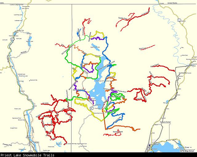
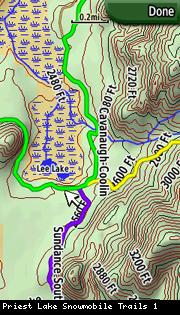
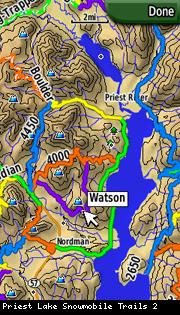
The mapset currently covers all of the snowmobile trails within the Priest Lake Ranger District along with the connector trails between Priest Lake and Schweitzer. Trails have been named and color-coded to match the official Priest Lake groomer map. The mapset is transparent and can be overlaid over other mapsets on the GPS, including the companion Priest Lake Topo mapset.

Visit Priest Lake Snowmobile Trails To Download.
Note: This map is not hosted by GPSFileDepot