GPS Process
THIS TOOL NO LONGER WORKS. Over time the USGS has changed their processes and this tool does not work. I leave the page for archival purposes. Please follow this tutorial to handle GNIS processing.
GNIS Process is a program that quickly downloads and processes USGS geographic names information system data and outputs a gpx file or shapefile that can be used to add data to maps.
Requirements
Features
- All-in-one GNIS downloading and processing.
- Handles the following GNIS types: airport, arch, area, arroyo, bar, basin, bay, bench, bridge, canal, cape, cemetery, church, cliff, crossing, dam, falls, gap, hospital, island, lava, locale, mine, park, plain, populated place, range, rapids, reservoir, ridge, school, slope, spring, summit, swamp, tower, trail, tunnel, valley, and well.
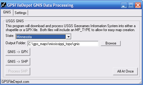
Screenshots
Instructions
The program is very self-explanatory. Directions are available in Part 5 of the Garmin Map Making Tutorial.
Installation
GNIS Process is for Microsoft Windows only.
- Download the installer. This will install GNIS Process on your PC and place shortcuts on the start menu.
- If the program doesn't run you most likely don't have the vb6 runtime files. Download & Install them here.
- The first time you run the program you will have to fill in all the settings. Just point the program to the proper files for PostGIS & FWTools. Fill in all your PostGIS information as well.
- If you need help installing PostGIS check out this tutorial.
- The program is now ready to download and process GNIS data.
Download
Current Version: 1.0.9
Production Date: 25 May 2009
Download Options:
1. Installer (131kb)
Note: A ![]() symbolizes an external link. That means it is not hosted by or provided by GPSFileDepot.
symbolizes an external link. That means it is not hosted by or provided by GPSFileDepot.