Kandahar TOPO Map
Created By: Indrid Cold
Last Updated: December 6th, 2009 3:12pm
Map Coverage:
North: 32°
West: 65°
East: 66°
South: 31°
Country: Afghanistan
Price: Free!
![]()
![]()
![]()
![]()
![]()
![]()
Most Popular Maps
- My Trails-High Quality Trail and POI Maps
- Arizona Topo
- World Topo - Eastern
- Florida Topo
- World shaded relief kmz
Other Maps By Indrid Cold (See All)
This map superseded by http://www.gpsfiledepot.com/maps/view/182/
Introduction
The purpose of this map is to provide map coverage of Kandahar and surrounding area.
Features
- Roads, settlements and water data including springs, wells and water tanks.
- Points of Interest, such as Med centers, passes, summits...
- 20 foot topographic contours
- English Transliteration, not: کندهار or قندهار
Coverage & Detail
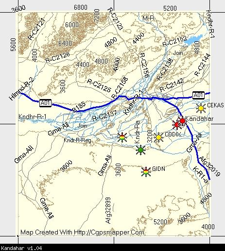
The following MapSource screenshot shows the coverage:
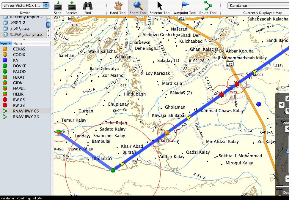
GPS screen shots showing detail:
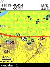
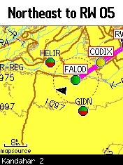
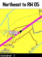
From RoadTrip:
Installation
Two options exist;
for Windows, download and run setup. The map will then appear in Garmin MapSource and can be added to your GPS by selecting it in MapSource and sending it to the GPSr.
For OS X, download the Mac .dmg version, double click it to mount the file. Instructions are in the Read First file.
 Download Windows Version [142B] (2873 Downloads)
Download Mac Version [142B] (1158 Downloads)
Need MapSource (Windows)? Click Here
Need RoadTrip/MapInstall/MapManager (Macintosh)? Click Here
GPS Usage
This map can be installed with any other Garmin Maps via Garmin MapSource or MapInstall (MapSource How-To Tutorial).
Photo details:
Kajaki Dam and reservoir - Helmund Province
x : 65.92506 y : 31.78115 Azimuth : 340

Changelog
Version 1.06 (01 Jan 09)
- re-typed the dunes that were showing up as a water feature on seaches.
Version 1.05 (24 Dec 08)
- Set levels to match new mapsets.
- Removed diacritics that didn't display properly on some Garmin units.
- Complete rebuild of NGA set.
- New Macintosh installer.
Version 1.04 (26 Nov 08)
- Highway labels display
Version 1.03 (23 Nov 08)
- Roads typed and labled as per World Basemap
- Added RNAV (GPS) Approach waypoints for OAKN
Version 1.02 (12 Nov 08)
- Additional NGA namesets
- TYPE and level updates
Version 1.01 (11 Nov 08)
- Updated NGA nameset
- Transliteration includes alternative placenames (POI's can search all name sets)
- TYPE and level updates
- Windows version now available
Version 1.00 (10 Nov 08)
- Initial release