Bost TOPO Map
Created By: Indrid Cold
Last Updated: December 6th, 2009 3:12pm
Map Coverage:
North: 32°
West: 64°
East: 65°
South: 31°
Country: Afghanistan
Price: Free!
![]()
![]()
![]()
![]()
![]()
![]()
Most Popular Maps
- My Trails-High Quality Trail and POI Maps
- Arizona Topo
- World Topo - Eastern
- Florida Topo
- WV-VA-KY Feb 3 2025 Public Map
Other Maps By Indrid Cold (See All)
This map superseded by http://www.gpsfiledepot.com/maps/view/182/
Introduction
The purpose of this map is to provide map coverage of Bost (Lashkar Gah) and the surrounding area.
Features
- Roads, settlements and water data including springs, wells and water tanks.
- Points of Interest, such as Med centers, passes, summits...
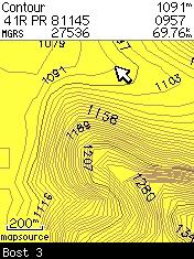
- 20 foot topographic contours
- English Transliteration, not: لښگرگاه
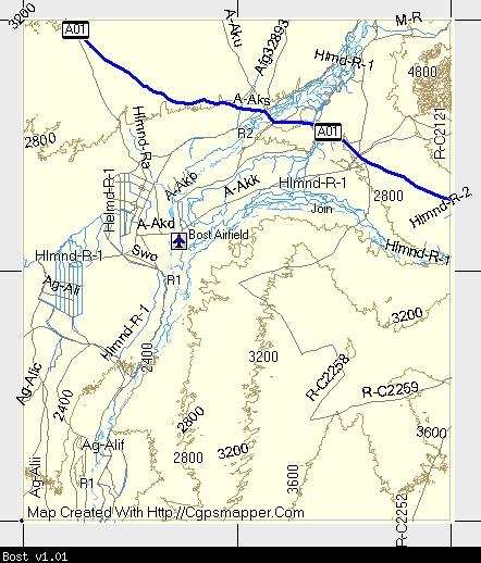
Coverage & Detail
The following MapSource screenshot showing the coverage:
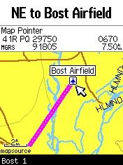
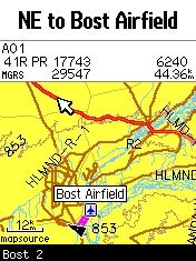
GPS screen shots showing detail:
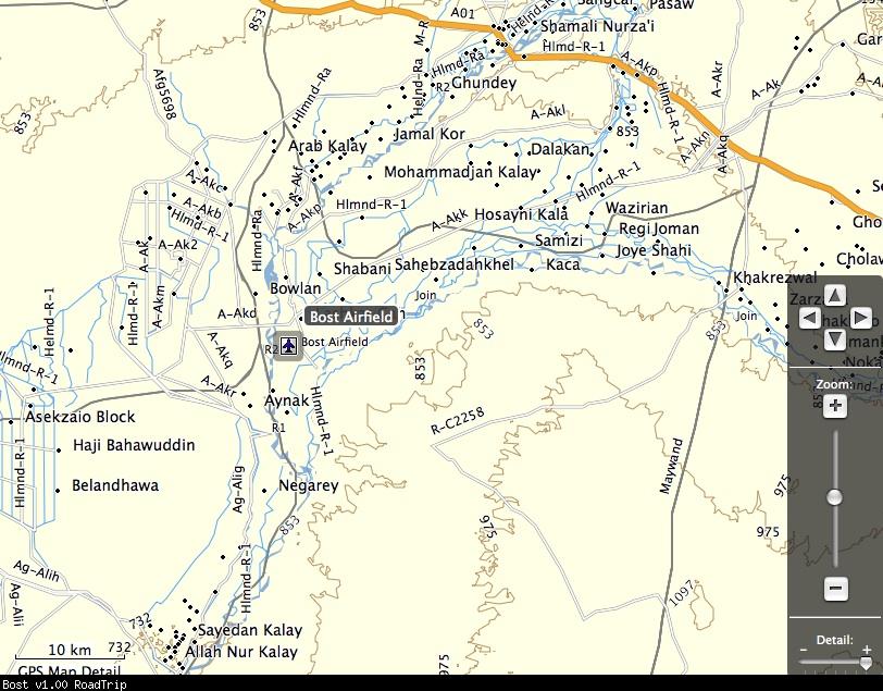
Screen shot from RoadTrip:
Installation
Two options exist;
for Windows, download and run setup. The map will then appear in Garmin MapSource and can be added to your GPS by selecting it in MapSource and sending it to the GPSr.
For OS X, download the Mac .dmg version, double click it to mount the file. Instructions are in the Read First file.
 Download Windows Version [142B] (1389 Downloads)
Download Mac Version [142B] (968 Downloads)
Need MapSource (Windows)? Click Here
Need RoadTrip/MapInstall/MapManager (Macintosh)? Click Here
GPS Usage
This map can be installed with any other Garmin Maps via Garmin MapSource or MapInstall (MapSource How-To Tutorial).
Photo: Qala-E-Bost Arch, National Geographic:

Changelog
Version 1.02 (23 Dec 08)
- Set levels to match new mapsets.
- Removed diacritics that didn't display properly on some Garmin units.
- Complete rebuild of NGA set.
- New Macintosh installer.
Version 1.01 (26 Nov 08)
- Highway labels display
Version 1.00 (23 Nov 08)
- Initial release