England Peak District Map
Created By: jolly47roger
Last Updated: June 21st, 2016 1:06pm
Map Coverage:
North: 53.5°
West: -2°
East: -1.5°
South: 53°
Country: United Kingdom
Price: 0
![]()
![]()
![]()
![]()
![]()
![]()
![]()
![]()
Most Popular Maps
- My Trails-High Quality Trail and POI Maps
- Arizona Topo
- World Topo - Eastern
- Florida Topo
- World shaded relief kmz
Other Maps By jolly47roger (See All)
This map covers the Peak District - the areas traditionally known as the White Peak and Dark Peak. Between Sheffield and Manchester and from Ashbourne to the Woodhead valley. This is a sample for my GBOpen map of England, Scotland and Wales. It is prepared from the Ordnance Survey Opendata District mapping and some Open Street Map data (footpaths, POIs and old railways).
This map is designed for hikers. It is not routable. It contains much more topographical detail than maps derived from Open Street Map (including Garmin TOPO Lite). There are more streams and woods, many individual buldings, more detailed contours and features such as cliffs and rock outcrops.
Revised June 2016 to include Rights of Way (where available) and road colours to match the UK Ordnance Survey colours.
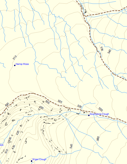
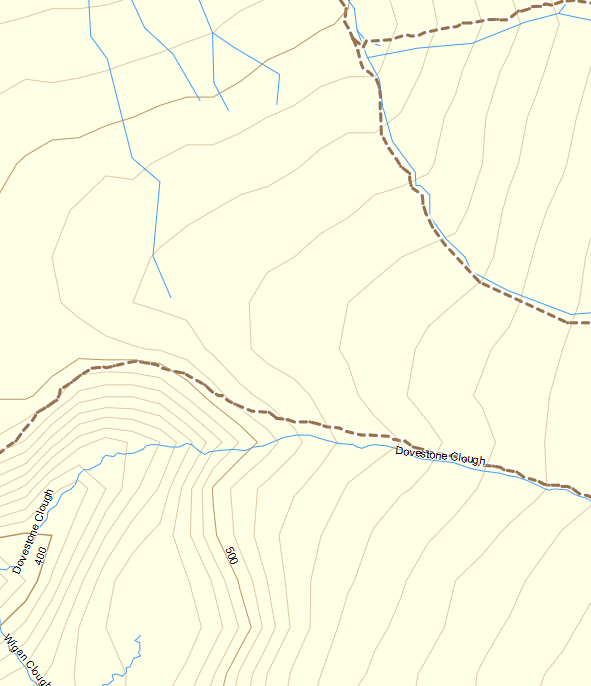
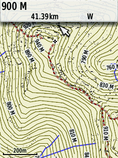
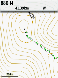
Here are some comparison samples.
Basecamp : Peak District
Open Street Map with contours
From an Etrex. Peak District
Garmin UK Topo Lite
 Download Windows Version [5MB] (3585 Downloads)
Download Mac Version [5MB] (1268 Downloads)